Radomskiego Street
|
|
SITE CHECK LIST |
|
|
Location
|
Site name |
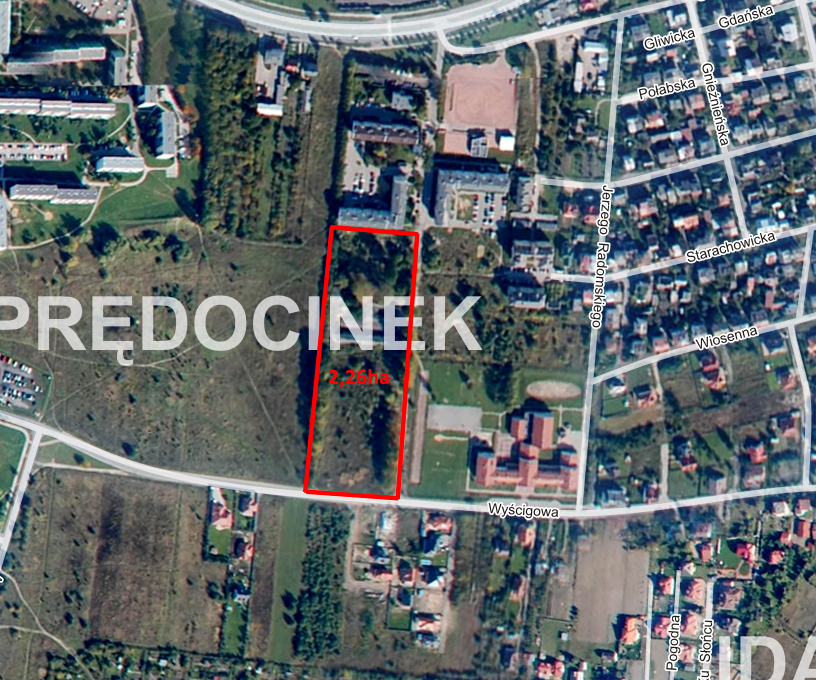
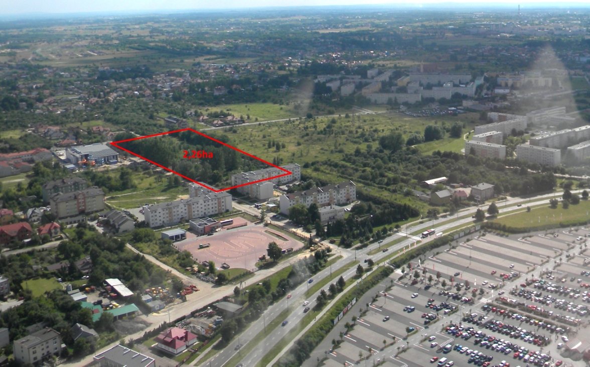
Radomskiego |
|
Town / Commune |
Radom |
|
|
District |
Radom |
|
|
Province (Voivodship) |
Mazowieckie |
|
|
Area of property |
Max. area available (as one piece) [ha] |
2,26 ha |
|
Possibility for expansion (short description)
|
- |
|
|
Property information |
Owner(s)
|
Municipality of Radom |
|
Valid zoning plan (Y/N) |
N |
|
|
Zoning
|
Housing area |
|
|
Land specification |
Soil class with area [ha]
|
V |
|
Differences in land level [m] |
2 |
|
|
Present usage
|
- |
|
|
Soil and underground water pollution (Y/N) |
N |
|
|
Waste materials on site (Y/N) |
N |
|
|
Underground water level [m]
|
2-3 |
|
|
Risk of flooding or land slide (Y/N) |
N |
|
|
Underground obstacles (Y/N)
|
N |
|
|
Ground and overhead obstacles (Y/N)
|
N |
|
|
Ecological restrictions (Y/N)
|
N |
|
|
Buildings / other constructions on site (Y/N)
|
Y, small building designated for demolition |
|
|
Transport links |
Access road to the plot (type and width of access road) |
9m asphalt road |
|
Nearest motorway / national road [km]
|
E7, 4 km |
|
|
Railway line [km] |
Radom, 2 km |
|
|
Railway siding [km]
|
Radom, 2 km |
|
|
Nearest international airport [km]
|
Warszawa, 100 km |
|
|
Nearest province capital [km] |
Kielce, 70 km |
|
|
Existing infrastructure
|
Electricity (Y/N)
|
Y |
|
Voltage [kV]
|
15 kV |
|
|
Available capacity [MW]
|
2 MW |
|
|
Gas (Y/N)
|
Y |
|
|
Calorific value [MJ/N m3/]
|
34,43 MJ/Nm3 |
|
|
Pipe diameter [mm]
|
63 |
|
|
Available capacity [Nm3/h]
|
500 |
|
|
Water supply (Y/N) |
Y |
|
|
Connection point (distance from |
0 m |
|
|
Available capacity [m3/24h]
|
1500 |
|
|
Sewage discharge (Y/N)
|
Y |
|
|
Available capacity [m3/24h]
|
8500 |
|
|
Rain water discharge (Y/N) |
Y |
|
|
Treatment plant (Y/N) |
Yes. 10 km north |
|
|
Telephone (Y/N) |
Yes |
|
|
Contact
|
Inwestor Assistance Office 53 Żeromskiego St. 26-600 Radom Tel.: 48 36 20 332, 48 36 20 538 e-mail: coi@umradom.pl |
|